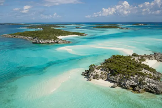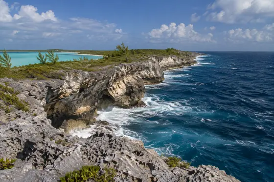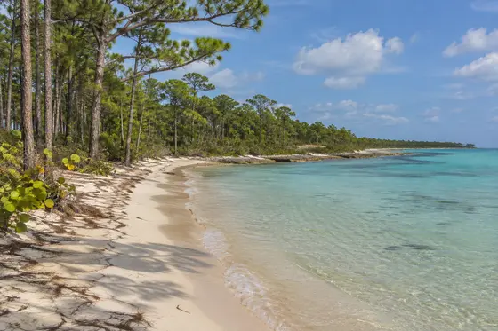
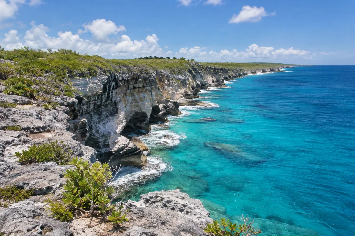
The name describes the geography rather well. Long Island extends in a narrow strip through the central and southern Bahamas, with settlements spaced along its principal road. The Atlantic shore is often rougher and more dramatic than the bankside coast. It pays to choose the side of the island according to weather rather than expecting all beaches to have the same conditions.
Across the island
The road passes coastal settlements, fields, low limestone hills and small shops. Clarence Town, towards the south, has distinctive church architecture and a harbour. Other villages offer different views of the water and opportunities to stop for a meal or provisions. Many roads leading to beaches are unpaved, so confirm that a rental vehicle is suitable and ask about public access.
The blue hole
Dean's Blue Hole, near Clarence Town, is perhaps the island's best-known natural feature. A deep opening lies close to shallow coastal water. The contrast between dark and pale blue water is memorable, but the depth and conditions deserve respect. Stay within your swimming ability, never explore its depths without appropriate professional guidance, and avoid jumping or diving from unfamiliar rocks.
A holiday at an easier pace
The island is a good choice for someone who wants a quiet beach holiday and enjoys discovering different stretches of coastline. Its length means that accommodation location matters. A room towards the north may be a considerable drive from attractions in the south. Confirm which airport to use and where to obtain essentials.
Give yourself several days rather than thinking of the island as a quick road stop. A sheltered beach in the morning, a late lunch in a village and a drive to a different part of the coast can fill a day pleasantly. Keep some flexibility for the wind, leave daylight for the return journey, and ask residents for advice before heading down unfamiliar tracks.
The two coastlines
An ocean-facing beach can be a fine place to watch the Atlantic on a windy day, while a bay on the western side may offer far gentler water. Choose the visit according to the actual sea conditions and your group's swimming ability. The coast is not continuously accessible by road, and not every cove has a public entrance. Rather than driving from one end of Long Island to the other in search of perfect conditions, ask about two or three sensible options in the area where you are staying and make your choice on the day.
Two airports, two different starting points
Long Island is nearly eighty miles long, so it is worth looking at the geography before choosing a flight. Stella Maris Airport (SML) serves the northern region, where much of the holiday accommodation is scattered around the northern settlements and coastline. Deadman's Cay Airport (LGI) is a useful starting point for the central and southern parts of the island. The official Long Island travel guide identifies both airports; check actual routes and connections directly with the airline before booking.
Plan your pickup with the accommodation in advance. Renting a car for a short road trip may make sense even if you intend to spend most of a holiday beside the water. Otherwise, arrange a driver for a particular outing instead of assuming a taxi will be waiting at every beach. The road distance also means that backtracking for forgotten belongings can take much of the morning. Take a small bag with drinking water, identification, a charged phone and a towel when leaving your accommodation. A paper map can be helpful when mobile reception is unreliable on a remote stretch of road.
Water views at the north end
The area around Cape Santa Maria is a good introduction to the island's northerly coast. The sea in the area can take on several shades of blue where the pale bank meets deeper water. The landscape changes quite quickly from broad sandy shore to rough, exposed rock and scrub as you approach the tip of the island. Columbus Point, on the northern headland, is the location of a monument connected with Columbus's voyage through the Bahamas.
The monument commemorates a particular interpretation of the historical landing place. The islands were already inhabited by Lucayan people long before the Europeans arrived, a point worth remembering when reading signs about discovery. Some details of the early voyages remain open to historical interpretation. The geographical setting, with headlands overlooking the ocean approaches, is interesting in its own right.
Before setting out, find out which roads and tracks are open and suitable for your transport. A rocky viewpoint can be spectacular but difficult to reach in poor weather. The beach at the northern end and the headland make a pleasant combination for a leisurely excursion, provided you allow enough time for the journey back.
The architecture and community of Clarence Town
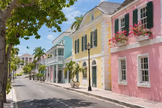
The twin-towered church buildings in Clarence Town are among its most recognisable features. Both are associated with Father Jerome Hawes, who built one as an Anglican priest and contributed to the other after becoming a Roman Catholic priest. St. Paul's Church and St. Peter and St. Paul's Church therefore look closely related despite being associated with different congregations. From the road, their solid pale walls and paired towers stand out against the low surrounding landscape.
These remain places of religious significance. View the exterior respectfully, ask about the possibility of entering, and be mindful of any services or private events taking place. A walk through a settlement is also an opportunity to notice the everyday architecture: porches positioned for airflow, carefully maintained gardens and buildings that have been adapted over time to suit a windy climate.
Clarence Town's harbour gives the settlement a second perspective. Small vessels, docks and the road serving the waterfront illustrate why the island developed around connections by sea. Make a proper lunch stop in town and leave time for a conversation rather than treating the churches as a brief photographic detour. Depending on where you are staying, you could put this town on a separate day's itinerary from the northern headlands.
What the limestone tells us
Much of the Bahamian landscape is made from carbonate rock. Water slowly dissolves parts of the limestone, opening cracks and forming underground spaces. Changes in sea level and the movement of groundwater over long periods have produced formations that are visible both along the shore and inland. The caves of Long Island offer quite a different impression from the bare limestone platforms exposed to Atlantic waves.
In the interior, Hamilton's Cave is known for its sizeable chambers and archaeological interest. It is one of the island's attractions where a knowledgeable guide adds real value. The rock may be irregular underfoot and cave entrances can be hazardous, even when a chamber appears to be close to the road. Find out in advance how to arrange a visit, rather than attempting to enter on your own. Wear secure shoes that you do not mind getting dusty.
While enjoying the rock formations, keep an eye on the vegetation growing around them. Plants have adapted to thin soils and exposure to salt. In a shady pocket, dense greenery may develop only a short distance from an open, dry ridge. It is a reminder that seemingly uniform limestone islands contain many small, different habitats.
Fishing, boatbuilding and the quieter flats
The shallow bankside waters provide feeding areas for bonefish, which are sought by visiting fly fishers. A guide can help a newcomer understand the importance of tides, visibility and wind direction, along with the techniques used in this traditional flats fishery. Arrange fishing permission, licensing and catch-and-release practices with the operator before the trip. Even a non-fisher may enjoy the opportunity to see the pale underwater landscape and watch the movements of small fish and wading birds from a respectful distance.
The island also has a tradition of wooden sloop racing. Long Island's regatta brings together sailors and locally built boats, and offers an insight into the shared maritime skills of the Bahamian islands. Ask the tourism office for event dates if a visit coincides with the regatta season rather than relying on an annual date from an old guidebook.
Food offers another connection to local traditions. At a small restaurant or takeaway, ask what seafood has arrived recently and whether a local soup or mutton dish is being prepared. Menus are often shorter than the ones found in big hotel districts, so it is helpful to call ahead for a special dietary request. A day spent among the settlements with a single planned outing on the water can be every bit as satisfying as a busy sightseeing schedule.